The interactions between human activities, such as farming, forestry and the built environment, are linked with processes that shape Ireland's environment, landscape and biodiversity. Land cover describes what is visible on the land surface. Land use describes the use or uses the land has been put to from a human perspective.
The CORINE (Co-ORdinated INformation on the Environment) data series has become a key data source for informing environmental and planning policy on a national and European level.
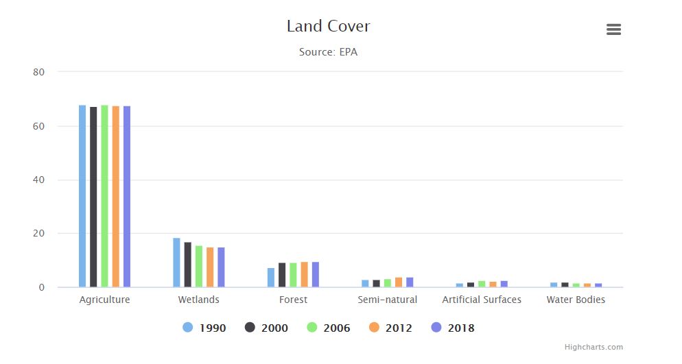
The most recent assessment (CORINE 2018) shows that agriculture is the primary Land Use Land Cover (LULC) type within Ireland (67.6% of national land cover), followed by wetlands (14.9%) and forestry (9.5%).
The Ordnance Survey of Ireland and the EPA are working on developing a high-resolution map of Ireland to be completed in 2021. Based on high resolution aerial images and the integration of sectoral data, the map will allow for a much more consistent picture of national land cover. The EPA is also developing a national land use map for Land Use, Land Use Change & Forestry (LULUCF).
Learn more about current trends in land use and land cover
